bonshaw map1
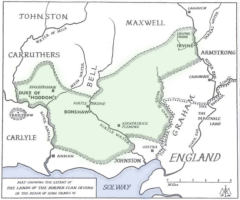
Bonshaw branch of IRVING lands on the Kirtle Water (stream) about the time of the Union of the Crowns (King James I of Scotland becomes also King James VI of England in 1603).
Shaded area in this circa 1603 map indicates lands north of the Solway Firth in eastern Scotland controlled mostly by Irvings with Bonshaw at the center. Other surnames of neighboring clans are shown.
Shaded area in this circa 1603 map indicates lands north of the Solway Firth in eastern Scotland controlled mostly by Irvings with Bonshaw at the center. Other surnames of neighboring clans are shown.